GPS Navigation Live Earth Maps
- 4.5
- Rating
- 500.00K
- Installs
- Free
- Price

 Analysis by App-foxy
When I need a straightforward route without turning navigation into a complicated project, GPS Navigation Live Earth Maps is the kind of app I am happy to try first. It sits in the maps and navigation category, and its main purpose is practical: help me plan a drive, follow spoken directions, and find useful places around me. That focus makes it easy to understand, but the real question is whether it offers enough value beside the navigation tools many people already have on their phones.
My overall impression is that it is best viewed as a convenient alternative rather than an automatic replacement for every established mapping service. It is free to install, rated for Everyone, and available on devices running Android 7.0 or later. That makes the entry barrier low, especially for someone who wants to test another navigation option without committing money before seeing how it fits into a daily routine.
How GPS Navigation Live Earth Maps fits into everyday driving
The app is developed by 8th Generation Apps -Global Earth Map Live apps, and it has built a noticeable audience for a relatively recent navigation product. It was released on May 16, 2025, and the current version is 1.46. The listing shows more than 500 thousand installs and an average score of 4.5 from around 323 ratings, while only a small handful of written reviews are visible. I read that combination as encouraging but still incomplete: plenty of people have installed it, yet the numerical score should not be treated as a substitute for a long history of detailed user feedback.
You May Also Like

 Blood Strike: 2.5 Anniversary
Blood Strike’s Loadouts Turn Every Drop Into a Tactical Gamble
A close look at Blood Strike’s custom loadouts: how fast access to signature weapons reshapes its battle royale rhythm, rewards preparation, and narrows the gap between fights.

 Pandora - Music & Podcasts
Pandora’s Music Is Easy to Start, but Harder to Recover
Pandora’s strength is its low-effort path from a seed to a station. Its weak spot is how much confidence it asks you to place in connection, setup, and quiet recovery.

 8 Ball Pool
 Is Built on Rivalries, Rematches, and Routine
A close look at the rivalries, rematches, shared routines, and unanswered safety questions that turn a quick pool match into a persistent mobile community.

 Samsung Music
’s Quiet Strength Is Playing What You Already Own
Its reach comes less from spectacle than from dependable access to a personal library. That simplicity is both the app’s strongest retention engine and its ceiling.

 AccuWeather: Weather Radar
AccuWeather Review: A Quick, Clear Forecast for Everyday Decisions
For everyday plans, the best forecast is the one you can understand quickly. AccuWeather makes rain timing, radar, and local conditions easy to act on, with a few trade-offs.

 Hill Climb Racing
Why Hill Climb Racing Still Turns Crashes Into One More Run
A tiny car, a bumpy hill and one more upgrade: Hill Climb Racing keeps resurfacing because its simple chaos makes every near-miss feel personal.
More From Our News Desk



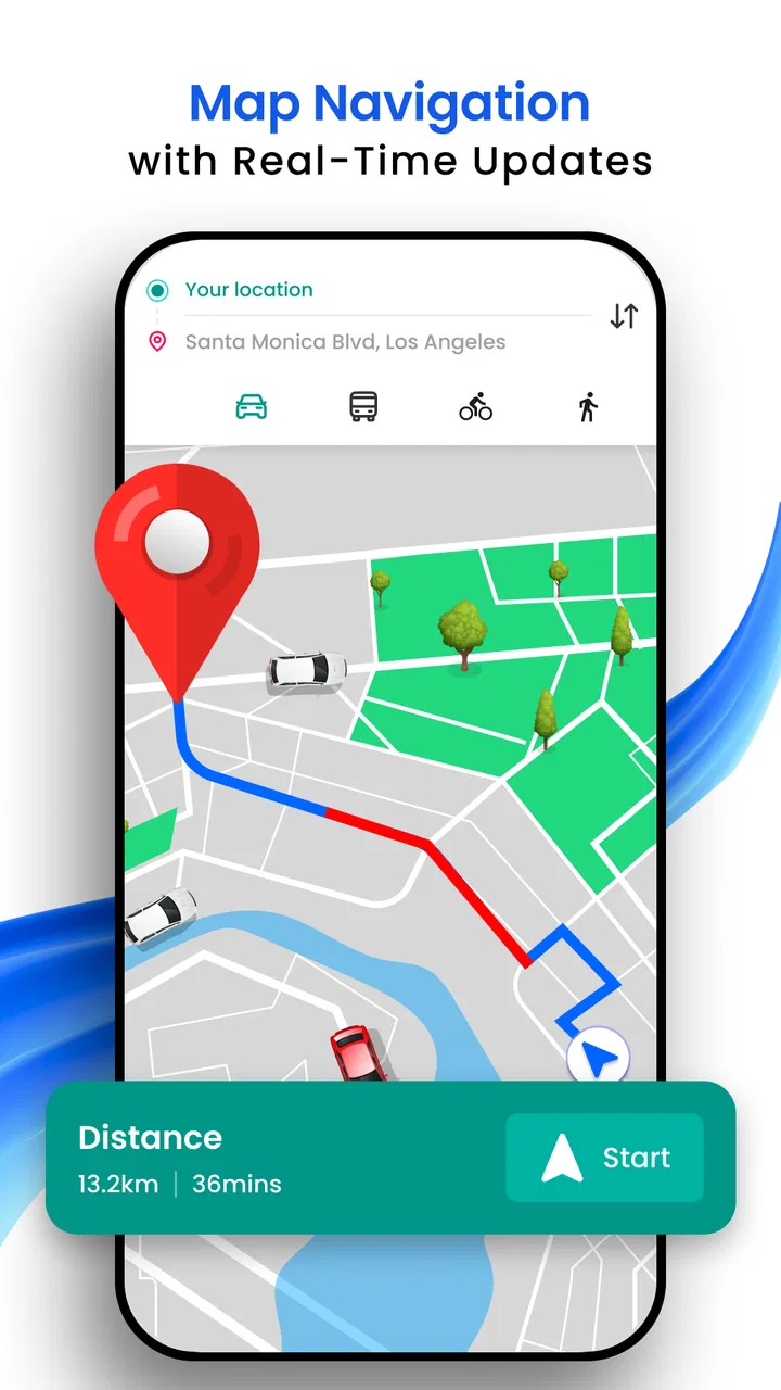
In use, the appeal is clear. I can enter a destination, follow a route, listen for voice guidance, and look for nearby places instead of switching between separate tools. That combination matters when I am driving through an unfamiliar area and need both directions and a quick answer to a practical question, such as where to stop or what is close to the road.
The most useful way to approach it is to prepare before moving. I would enter the destination while parked, check that the suggested route makes sense, and then begin driving with the phone mounted where the screen is easy to see without becoming a distraction. Voice navigation is especially useful here because it lets me keep my attention on traffic instead of repeatedly touching the display.
What the free access really means
The app itself is free, which is an important advantage for casual drivers. I can install it and assess the basic experience without paying an upfront purchase price. That is particularly helpful if I am comparing navigation apps, setting up a spare phone, or helping a family member find a simpler route-planning option.
There are in-app purchases ranging from $3.49 to $19.99 per item. That means the free starting point should not automatically be interpreted as an entirely cost-free experience in every situation. The sensible approach is to use the no-cost portion first, notice which functions are available for normal driving, and only then decide whether any paid item solves a problem I actually have. Free access is valuable here because it lets me test the workflow before spending anything.
I would not describe the paid side as a guaranteed bargain because the usefulness of those purchases depends on what I personally need and how often I drive. A daily commuter may see more value in extra convenience than someone who only needs directions a few times a month. Since the listed purchase range covers several possible price points, I would also avoid buying impulsively just to unlock something I may rarely use.
Following directions without overcomplicating the trip
The core experience is built around reducing the number of decisions I have to make while driving. I choose a destination, review the route, and let the voice guidance handle the reminders. That is more comfortable than trying to memorize unfamiliar turns, especially on a first visit to a new neighborhood.
A small but useful habit is to check the route in advance rather than waiting until I am already moving. This gives me a chance to spot an awkward destination pin, recognize the general direction, and decide whether the route matches my actual plan. If I am going to a large venue, business area, or unfamiliar address, I would also use the nearby-places function before leaving so I know what options may be available once I arrive.
Voice instructions are not only for long journeys. I find them useful on short urban trips where frequent turns make screen checking inconvenient. At the same time, I would keep the volume at a level that does not mask horns, sirens, or other road sounds. Navigation software can support attention, but it cannot replace it.
Nearby places can change how I use the app
The nearby search is more than a decorative extra because it changes the app from a route viewer into a small trip-planning tool. If I am driving to an unfamiliar part of town, I can look for a useful stop around the destination instead of opening a second app and rebuilding the context there.
One realistic example is an evening appointment across town. Before leaving, I would set the appointment location as the destination, inspect nearby places for a suitable stop, and then use voice guidance during the drive. If plans change, I can search around my current area rather than relying entirely on memory or random roadside signs. That workflow is simple, but it saves the kind of small interruptions that make navigation feel stressful.
There is also a trade-off. Nearby results are only helpful when I still apply judgment. I would not assume that the first result is the closest practical entrance, the best option for parking, or the right place for a time-sensitive stop. The app can help me discover possibilities, but I still need to verify the final choice from the road situation and the destination itself.
Where it differs from familiar alternatives
Compared with the usual full-service mapping apps, GPS Navigation Live Earth Maps feels more focused on getting directions and nearby information into one accessible experience. That can be appealing if I want less clutter or simply prefer testing a separate navigation app instead of relying on the default tool on my phone.
The established alternatives may be a better fit for people who depend heavily on broad travel ecosystems, extensive place histories, detailed review communities, transit planning, or deeply integrated location services. I would choose one of those familiar options when I need a large amount of local context and already have years of saved places there.
On the other hand, this app can make sense for someone who wants a dedicated driving aid without paying at the installation stage. It is also a reasonable backup to keep available when I want another route-planning interface. I would not judge it solely by whether it replaces every feature of a major mapping platform; its value is stronger when I measure how quickly it handles the basic tasks I actually perform.
Practical strengths and real friction
The strongest point is the combination of driving directions, spoken guidance, and nearby-place discovery in a single free-to-start app. Those functions cover the needs of a driver who wants assistance from departure to arrival. The Everyone content rating also makes it approachable for a broad household audience, although younger users should still use it only with appropriate supervision while travelling.
The main friction is that navigation quality is not just about the interface. Route usefulness depends on the accuracy and freshness of the underlying map information, the clarity of the destination, and the conditions on the road. I would always treat the suggested route as assistance, not as an unquestionable instruction. If a sign, road closure, or traffic officer contradicts the screen, the real-world situation takes priority.
Another limitation is the uncertainty that comes with a newer product and a relatively small written-review sample. The rating is promising, but I would be cautious about assuming that every location, device, or driving style will feel equally polished. My own test would include the roads and places I use most often, rather than deciding after one short trip.
Phone setup also matters. A weak mount, low battery, poor visibility, or an inconvenient speaker position can make any navigation app frustrating. I would test the voice volume while parked, position the device securely, and avoid typing once the car is moving. These are simple steps, but they make a larger difference than changing between apps repeatedly during a trip.
Who is likely to get the most value
I think the best match is a driver who wants basic route guidance, spoken instructions, and nearby-place searches without paying before trying the app. It suits occasional travelers, people exploring a new city by car, and anyone looking for a secondary navigation option. A family member who finds a large mapping platform overwhelming may also appreciate the narrower purpose.
It can be useful for planning errands as well. I might search for a destination, identify a nearby stop, and organize the order of the trip before leaving home. That is more efficient than starting the car first and improvising every decision. The app becomes especially practical when the destination is unfamiliar but the trip itself is not complex.
I would be more selective if I were a professional driver, travelling through remote areas, or depending on advanced mapping features every day. In those cases, I would compare it carefully with the navigation service that already handles my saved locations, traffic habits, travel modes, and local information. A free installation is not enough reason to abandon a tool that has already proven dependable for demanding work.
I would also skip it if I only want a highly detailed local discovery platform rather than a driving-focused navigator. Nearby places are helpful, but someone choosing an app mainly for extensive venue research, community reviews, or a broader travel-planning system may find a conventional alternative more suitable.
How I would test it before relying on it
My first test would be a familiar route, not an important appointment. I would compare the suggested turns with roads I already know, listen for whether the voice prompts arrive at useful moments, and see how easily I can correct a destination or change my plan while parked. A familiar drive gives me a safe reference point for judging the experience.
Next, I would try a destination with a nearby-place search. I would check whether the results help me complete a real errand, such as finding a stop close to an appointment, rather than merely browsing. This reveals whether the extra discovery function fits naturally into my routine or feels like a separate feature I would forget to use.
Only after those tests would I consider an in-app purchase. I would identify the exact problem the purchase is meant to solve, compare that benefit with how often I drive, and keep the free version if the paid improvement is not meaningful. The listed price range makes this order of operations sensible: start free, test honestly, and pay only for a clear personal benefit.
My verdict on the value
GPS Navigation Live Earth Maps earns a positive recommendation from me as a free-to-start driving app with a clean, understandable purpose. Its strongest value comes from combining route guidance, voice instructions, and nearby-place searches for ordinary trips. I like that I can evaluate it without an upfront charge, and the broad device compatibility makes it accessible to many Android users.
I would still keep expectations measured. It is not automatically the best replacement for a mature mapping ecosystem, and I would not rely on any navigation app blindly in difficult or unfamiliar conditions. The limited number of written reviews also means I would personally test it on regular routes before making it my only navigation tool.
For occasional drivers, backup-phone users, and people who want a simple way to get directions while discovering useful places nearby, I think it is worth installing. For heavy travelers and drivers who need a deeply established mapping service with a wider set of specialized tools, another option may deliver better long-term value. My final advice is simple: try the free experience on a familiar route, use the nearby search during a real errand, and consider paid items only when they offer a benefit you can clearly feel. That makes the app easy to recommend as a practical test, but not as a universal replacement.
FAQs for GPS Navigation Live Earth Maps
01What is GPS Navigation Live Earth Maps, and what can I use it for?
GPS Navigation Live Earth Maps is a navigation and mapping application designed to help users find locations, plan routes, and follow directions while traveling. It may provide map views, live traffic information, satellite or Earth imagery, nearby places, and location search tools. It can be useful for driving, walking, exploring unfamiliar areas, or checking a destination before starting a trip.
02Does GPS Navigation Live Earth Maps work without an internet connection?
The app’s core navigation features generally depend on an active internet connection to load maps, search for places, calculate routes, and refresh traffic or location data. Some functions may continue working with previously loaded information, but users should not assume that complete offline navigation is available. If you plan to travel through areas with weak coverage, check the app’s offline options before relying on it.
03Is GPS Navigation Live Earth Maps accurate and suitable for driving?
The application can be helpful for everyday navigation, but its accuracy depends on GPS reception, map data, traffic updates, device settings, and the quality of the available network connection. Routes and estimated arrival times may change, and road conditions can be different from the information shown. Drivers should always follow road signs, local traffic laws, and safe driving practices rather than relying exclusively on the app.
04What permissions does GPS Navigation Live Earth Maps require?
To provide navigation and location-based services, GPS Navigation Live Earth Maps may request access to your device’s location, including permission to use location services while the app is open. It may also need internet access and, depending on its features, notification or background-location permissions. Review each permission request carefully and grant only the access you consider necessary for the features you intend to use.
05Is GPS Navigation Live Earth Maps free to download and use?
The application may be available as a free download, but some features can depend on advertising, optional purchases, subscriptions, or limitations within the free version. Before downloading, review the current listing in the official Android or iOS store to confirm pricing, supported devices, in-app purchase details, and subscription terms. Also check the developer’s privacy information to understand how location and usage data may be handled.
Pros
- Live traffic updates help avoid congestion and delays.
- Street View makes it easier to recognize destinations before arrival.
- Offline map support can be useful in areas with weak mobile coverage.
- Voice guidance lets you navigate without constantly checking the screen.
- Multiple map views provide helpful context for planning unfamiliar routes.
Cons
- Some features may require an internet connection or additional downloads.
- Location tracking can noticeably affect battery life during long trips.
- Traffic and map data may be outdated in less-covered regions.
- Frequent notifications or ads can interrupt the navigation experience.
- Accurate GPS guidance may be limited indoors
- underground
- or between tall buildings.

GPS Navigation Live Earth Maps
Gallery